Free Tools
Sector tools, built and shared openly.
GAB Climate Smart builds practical GIS, environmental, and agribusiness tools for operators, consultants, and development actors working in Ghana and West Africa. We share them freely because better information produces better land, farm, and resource decisions.
Available Now
Map & site tools
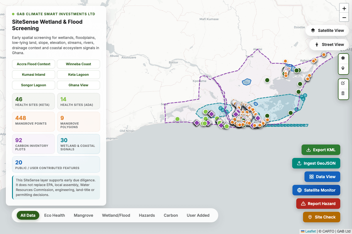
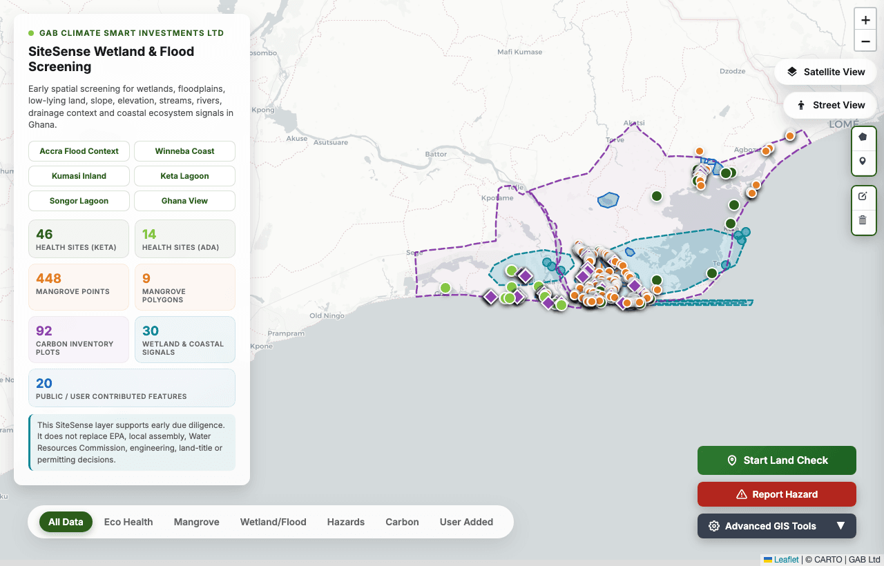
GIS · Flood Susceptibility
GAB FloodSense — Flood Suitability
Find out whether a location in Ghana is flood-prone. Drop a pin, draw a plot boundary, or upload your own GeoJSON/KML polygon. FloodSense estimates flood susceptibility from elevation, slope, rivers, wetlands, and open water, and tells you which of Ghana's known flood zones your site most resembles.
Why use this tool
Protect your property investments from flooding and understand the physical flood drivers before buying or building.
Used by: Property developers, prospective land buyers, municipal officers, civil society
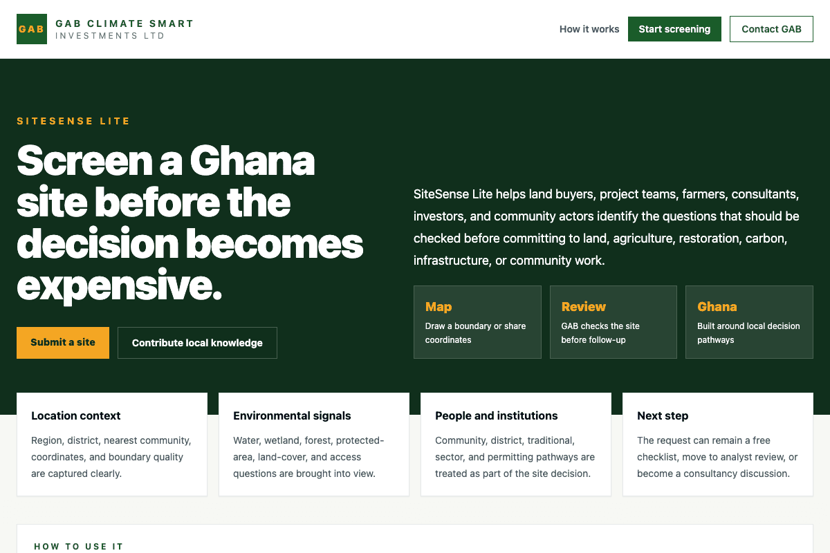
Site Screening · GIS Intake
SiteSense Lite
Draw a site boundary and submit project details to receive a first-pass GIS screening checklist. Ideal for early environmental and social impact risk assessments (ESIA) in land, farming, and conservation.
Why use this tool
Identify early environmental red flags, assess land suitability, and streamline regulatory due diligence before investing capital.
Used by: Land buyers, project developers, agribusinesses, NGOs, consultants
GIS · Protected Areas
Ghana Ramsar & Wetland Checker
Screen any location in Ghana against Ramsar-designated wetlands, mangrove zones, and protected natural resource areas. Enter a place, coordinates, or click the map to see instantly whether your site intersects a protected boundary.
Why use this tool
Find out before a regulator does. Avoid committing capital to land that is clearly constrained by wetland or protected-area designations.
Used by: Land investors, environmental consultants, ESG and finance teams, project developers
Agribusiness · Partnerships
Farm Block Explorer
Explore GAB's 53 mapped production blocks at Aframso on an interactive satellite map. Check block size, crop status, health indices (NDVI), and lease or joint venture availability.
Why use this tool
Access real-time block-level operational data and submit lease interest directly from an interactive GIS map.
Used by: Agricultural investors, contract growers, farm lease operators, processors
Environmental Screening Suite
Lite check tools
Free two-minute screeners covering Ghana’s permitting, carbon, biodiversity, community, governance, and reporting frameworks. Each returns a preliminary result and your next steps.
Regulatory Lite
Your EIA tier, the laws that apply, and your next steps under Ghana law.
Open toolGreen Carbon Lite
Carbon project eligibility against the Ghana Carbon Registry, Forestry Commission, and EPA.
Open toolBioMainstream Lite
Protected-area proximity, species risk, and water-body impact triggers.
Open toolConsentTrack Lite
Required consultation type, checklist gaps, and grievance risk before you engage.
Open toolResourceMap Lite
Likely institutional actors, resource issues, and governance gaps for your area.
Open toolReportBridge Lite
Which multilateral agreements apply, what must be reported, and where data comes from.
Open toolEfficiency Lite
Scope 1, 2, and 3 emissions from your resource use, with efficiency recommendations.
Open toolIn Development
Coming next
Tools we are building from our own consultancy and farm operations work. All are grounded in real field conditions and Ghanaian regulatory context.
Blue Carbon · MRV
Carbon Potential Estimator
Estimate the blue carbon sequestration potential of a coastal or wetland site using area, vegetation class, and soil depth inputs. Based on IPCC Wetlands Supplement methodology.
In development
Agribusiness · Finance
Crop Block Profitability Checker
Model the gross margin of a cassava or maize production block by entering area, yield assumption, input cost, and market price. Designed for Ghanaian commercial farm conditions.
In development
Work With Us
Interested in these tools?
Whether you want to stay updated when new tools launch, partner with us to build something for your sector, or commission a tool for your organisation, tell us and we will follow up.
- Development finance actors and NGOs working in land, water, or agriculture
- Environmental consultants needing GIS tools built to local spatial data
- Agribusinesses and processors wanting farm data tools for their operations
- Research institutions exploring AI-assisted field data and MRV systems
Why We Build Tools
Introducing AI and spatial intelligence into Ghanaian agribusiness is part of what we do.
Our consultancy work in GIS, drone mapping, satellite monitoring, and Blue Carbon MRV produces practical methods that can serve more than one project. These tools share useful parts of that work with the sector while opening a clear path for deeper engagements.